Status yellow weather alert for Ireland
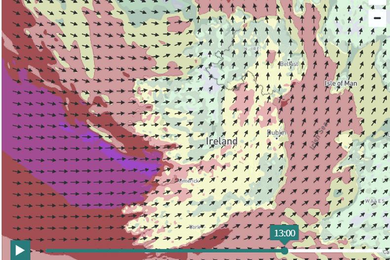
Met Éireann has issued a status yellow weather alert for the whole country. Winter showers of hail, sleet and snow are spreading eastwards and will lead to icy conditions. Later on Saturday, a more persistent band of rain and sleet will cross the country, turning to snow for a time, particularly over the midlands and north, and over high grounds elsewhere. The combination of sleet, snow and strong winds will lead to reduced visibility and hazardous driving conditions. This warning is in place until 4pm on Saturday.
A status red wind warning for Galway and Clare
There will be very severe winds associated with storm Jorge on Saturday. Westerly winds will reach average speeds of 85km/h to 100km/h in places, with gusts of 130km/h to 145km/h and an elevated risk of coastal flooding. This warning will remain valid from 1pm to 4pm on Saturday.
Status orange wind warning for western counties
Severe winds are also expected in counties Donegal, Leitrin, Sligo, Mayo, Galway, Clare and Kerry. Southwesterly winds quickly veering west and later northwest will reach mean speeds of 65km/h to 80km/h with gusts of 110km/h to 130km/h, possibly stronger in exposed areas with an elevated risk of coastal flooding. This warning will remain in place until 3pm on Sunday.
Rainfall warning for Munster, Connacht and Donegal
There is also a rainfall warning in place as accumulations from 20mm to 30mm are expected. Up to 40mm to 50mm is possible in mountainous areas, with a continuing risk of flooding due to already saturated ground and elevated river levels. This warning is in place until midnight on Saturday.
Read more
Scariff Mart called off on Saturday due to Storm Jorge
10 tips for driving machinery in flooded conditions
Status yellow weather alert for Ireland
Met Éireann has issued a status yellow weather alert for the whole country. Winter showers of hail, sleet and snow are spreading eastwards and will lead to icy conditions. Later on Saturday, a more persistent band of rain and sleet will cross the country, turning to snow for a time, particularly over the midlands and north, and over high grounds elsewhere. The combination of sleet, snow and strong winds will lead to reduced visibility and hazardous driving conditions. This warning is in place until 4pm on Saturday.
A status red wind warning for Galway and Clare
There will be very severe winds associated with storm Jorge on Saturday. Westerly winds will reach average speeds of 85km/h to 100km/h in places, with gusts of 130km/h to 145km/h and an elevated risk of coastal flooding. This warning will remain valid from 1pm to 4pm on Saturday.
Status orange wind warning for western counties
Severe winds are also expected in counties Donegal, Leitrin, Sligo, Mayo, Galway, Clare and Kerry. Southwesterly winds quickly veering west and later northwest will reach mean speeds of 65km/h to 80km/h with gusts of 110km/h to 130km/h, possibly stronger in exposed areas with an elevated risk of coastal flooding. This warning will remain in place until 3pm on Sunday.
Rainfall warning for Munster, Connacht and Donegal
There is also a rainfall warning in place as accumulations from 20mm to 30mm are expected. Up to 40mm to 50mm is possible in mountainous areas, with a continuing risk of flooding due to already saturated ground and elevated river levels. This warning is in place until midnight on Saturday.
Read more
Scariff Mart called off on Saturday due to Storm Jorge
10 tips for driving machinery in flooded conditions


 This is a subscriber-only article


SHARING OPTIONS: